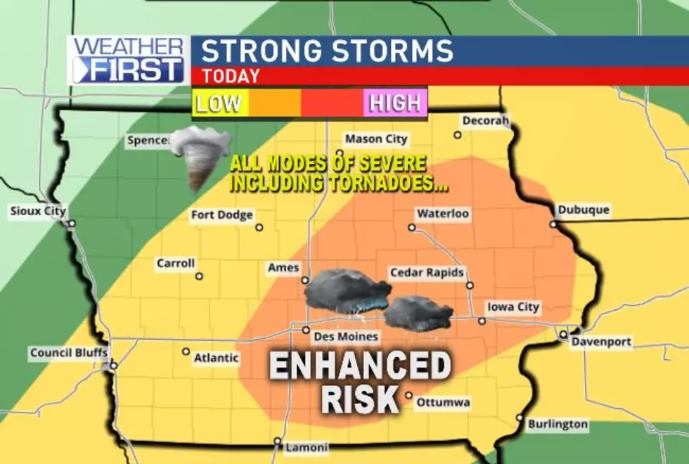
Flash Flood Watch for Most of Iowa; Tornadoes Also Possible Today
What was once tropical storm Cristobal is continuing to move north and today the state of Iowa will see its impacts. After it passes Iowa, it could turn into a huge cyclone.
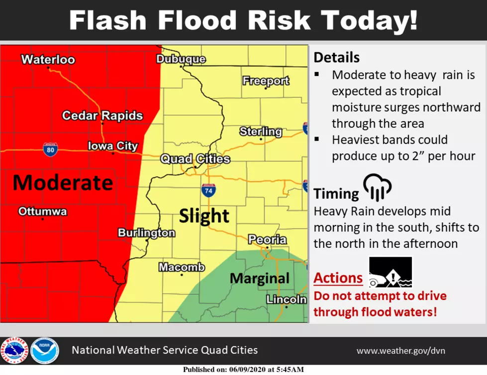
The storm is advancing its way north this morning and is expected to bring heavy rain across the eastern two-thirds of Iowa. This graphic from the National Weather Service shows the scope of the Flash Flood Watch, which also covers a large part of Missouri, parts of Illinois, Minnesota, and Wisconsin. The Flash Flood Watch that covers a large part of Iowa is in effect from 11 a.m. Tuesday morning through 10 p.m. Tuesday night.
The heaviest rain in the Cedar Rapids/Iowa City area is expected to begin late this morning and carry through most of the afternoon. Isolated tornadoes are also possible as the system tracks north. You can see live radar from our weather partner, CBS 2 HERE.
The National Weather Service says widespread areas of one to three inches of rain are expected today, with some areas seeing as much as 5 inches. That means moderate Flash Flooding concerns today and that we may need to keep an eye on area rivers in the coming days. More rain is forecast for the area tomorrow, though much lighter amounts, before at least five straight days of dry weather are anticipated.
Once Cristobal's remnants move away from Iowa, Greg Carbin of the Weather Prediction Center says the cold front that will be sweeping across the midwest later in the week will combine with Cristobal. He tells NBC News,
“The two will eventually merge into a large cyclone. It’s a pretty fascinating interaction we’ll see over the next couple of days.”
Thankfully, we won't see that impact here in Iowa.
KEEP READING: What to do after a tornado strikes
More From 98.1 KHAK