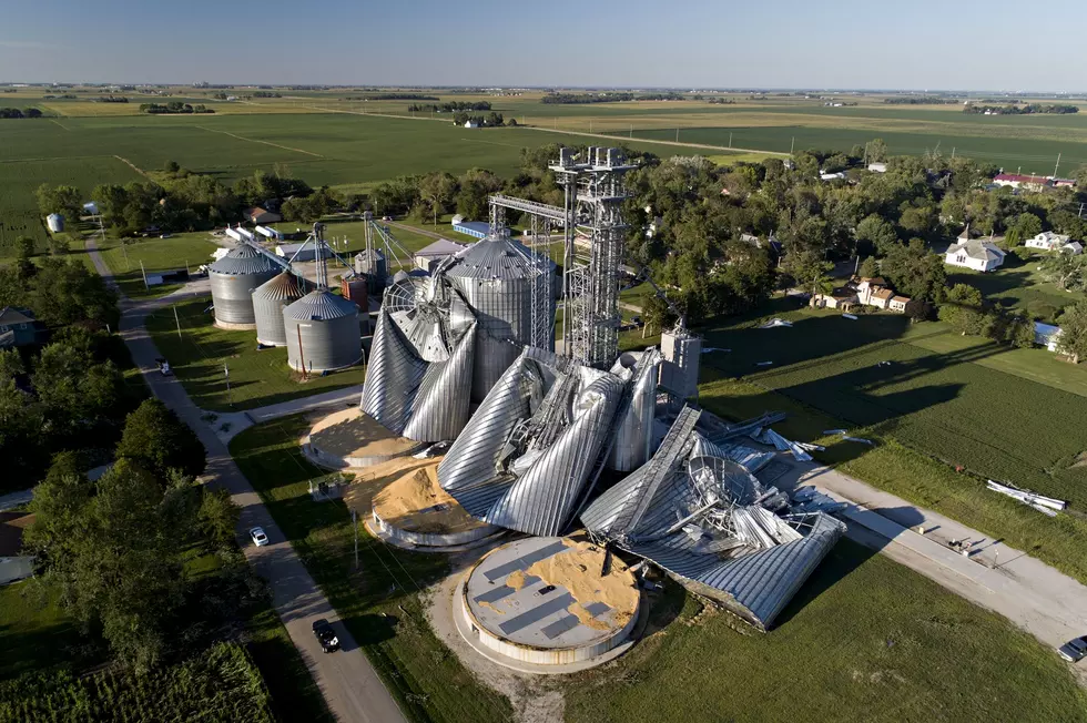
August Derecho Was Costliest Thunderstorm Event in History of U.S.
To have a Midwest city endure [such] wind speeds, and also see such a devastating impact to a large volume of regional crops, is almost unbelievable. I don’t think most of the country truly realizes how severe the event ended up being.
The quote above is from Steve Bowen, head of catastrophe insight at insurance broker Aon. He sent those words in an email to the Washington Post. To everyone living in the path of the storm, what happened on August 10 is still "almost unbelievable." Unfortunately, we see every day how real it was/is.
That horrific thunderstorm event that rolled through South Dakota, Iowa, Minnesota, Illinois, Indiana, and Ohio ten weeks ago today caused more damage than any other in U.S. history, according to NPR.
The National Weather Service says maximum winds from the derecho hit in Cedar Rapids at an estimated speed of 140-miles-per hour, equal to a Category 4 hurricane or EF3 tornado. If confirmed, it would be the strongest wind in the history of Iowa, outside a tornado.
NOAA (National Oceanic and Atmospheric Administration) says the storm caused $7.5 billion in damage. That's the second-costliest "weather and climate disaster" in the U.S. this year behind Hurricane Laura, which left $14 billion of damage in its wake. The agricultural impacts from the derecho may take the $7.5 billion figure even higher.
Sixteen different disasters have struck the U.S. so far this year, tying a record for a single year. The total impacts of the western wildfires, Hurricane Sally, and droughts still to be determined.
The recovery continues for businesses and families, with lots of help from local businesses and many individuals, organizations, and businesses that have come great distances to help. We appreciate them all. We need them all.
PHOTOS: Massive 2020 Storm Causes Widespread Damage in Cedar Rapids
More From 98.1 KHAK


![Concerts & Comedy Shows Coming to Iowa in 2026 [LIST]](http://townsquare.media/site/675/files/2026/01/attachment-copy-of-copy-of-copy-of-copy-of-copy-of-copy-of-copy-of-copy-of-copy-of-copy-of-copy-of-untitled-2.jpg?w=980&q=75)


![All the Grandstand Shows For 2026 County/State Fairs in Iowa [LIST]](http://townsquare.media/site/675/files/2024/07/attachment-gjcf.jpg?w=980&q=75)


